Key Takeaways
- RTK GPS significantly improves the accuracy of agricultural drones, reducing positional drift to mere inches.
- Operators can choose between a portable RTK base station or a network-based NTRIP service for better positioning.
- Accuracy of RTK ensures consistent spray application, preventing overlaps, skips, and wasted products.
- RTK is also crucial for scouting, providing accurate data for mapping and analysis.
- Setting up RTK correctly is essential; improper configurations lead to inaccurate results.
If you’re flying a spray drone without RTK GPS, you’re guessing about some things. Unfortunately, guessing costs money.
I used to be amazed watching my car GPS put me right on the roadway, and even in the right lane, until I learned the app was simply snapping me to the closest position within it’s mapping system.
Raw GPS signal gets you close, but close doesn’t cut it when you’re trying to follow the exact path your tractor and planter took. That’s the core challenge of agricultural drone GPS accuracy: satellite-only positioning drifts 1–3 meters, and that drift can show up as stripes on your crop.
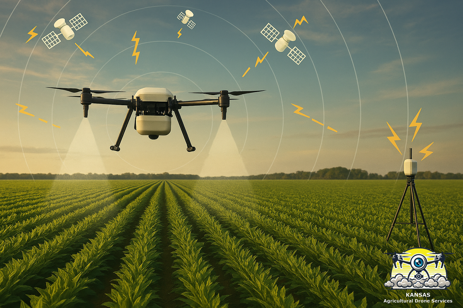
That’s where RTK GPS for drones comes in — Real-Time Kinematic positioning. A ground-based reference station corrects the drone’s satellite signal in real time, tightening your positional accuracy to an inch or two. Some operators run a portable base station on the field edge. Others connect to a regional CORS network via NTRIP, skipping the tripod entirely and pulling correction data straight over cellular / internet connections. Either way, the result is the same: a drone that flies like it’s on rails with repeatable precision.
I’ll be blunt: RTK is the difference between a drone that wanders around trying to do good work and a drone that’s a real farming tool. It is especially useful when running a large agricultural spray drone around obstacles and applying herbicides. Why would a farmer who worries about controlling spray drift ever run without RTK? Running an agricultural drone without RTK requires a lot of guessing about the position of the drone and things on the ground. Guessing leads to lost money.
What RTK Actually Does
RTK takes the imprecise GPS signal you collect from satellites and tightens it using a ground-based base station, or in the case of network RTK using a series of base stations. Base stations know exactly where they are, and your drone system uses that to correct the drone’s position in real time.
It does this by comparing the stable location of a base station (or multiple stations) to the signals it receives from satellites. The system continuously compares satellite signals against the known fixed position of base stations, filtering out atmospheric interference and timing variations caused by shifting satellite orbits. The result is centimeter-level accuracy delivered to your drone in real time.
That’s the whole trick. No magic. Just math.
But here’s the part sales folks won’t tell you: RTK only works if you set it up right. And many folks don’t. They plop their portable base station on the levee, hope for the best, and then start flying missions’ mere moments later. The result is the appearance of precision but is anything but precise. Enabling spray drone RTK systems takes just a bit of discipline.
Common RTK Options for Agricultural Drones
First, let’s talk about the two most common ways to achieve RTK accuracy.
Option 1: Portable RTK Base Station
The first option is a local portable base station—the tripod‑mounted unit you place on the field edge. It looks similar to survey equipment and functions the same way surveyors work. It finds its location from the GPS satellites, then remains stable and collects satellite data over time to becomes more convinced of its location with each passing moment. It broadcasts that information to your controller, which sends it on to your drone giving you consistent, survey‑grade accuracy.
Placing the base station on an exact same spot, preferably a surveyed spot, allows repeated accuracy day after day. Ideally, you would set a survey monument on the edge of each field you fly and always set up the base station on that spot.
Operators who prefer predictable, self‑contained workflows like this route because once the base is locked in, the drone repeats its lines with absolute consistency. It’s also a one‑time investment, which appeals to anyone who prefers owning their precision tools rather than paying for them indefinitely.
Option 2: NTRIP (Network RTK, No Base Station Required)
The second option is a network‑based RTK service, most commonly delivered through an NTRIP network. NTRIP stands for Networked Transport of RTCM via Internet Protocol. Further, RTCM stands for Radio Technical Commission for Maritime Services
Instead of running your own base station, you connect to a regional grid of permanently surveyed reference stations (permanently mounted version of the portable base station) —often the same CORS (Continuously Operating Reference Stations) used by surveyors and state agencies. The network blends data from multiple towers to generate a correction stream tailored to your exact location, then delivers it over the internet or cellular connection to your controller. It’s plug‑and‑play, no tripod required, and the accuracy follows you as you move between fields, counties, or states as long as you have connection to the network.
Some states allow citizens to connect to their CORS networks through NTRIP. Often for free! Unfortunately, Kansas does not and so I subscribe to an affordable service. If you are also in a state without free CORS access, there are several providers with affordable services. I subscribe to RTKDATA, which is the most affordable service I could find. In fact, I host a CORS tower at my house and provide the feed into the RTKDATA network. It is my contribution to other drone flyers and farmers in my County who wish to use an affordable GPS RTK for their operations.
Setting Up RTK Step by Step: DJI & Revolution Drones
Setting up accurate RTK base station on a Revolution Drones system is actually pretty painless if you follow the steps and don’t try to cowboy your way through it. Here’s how I explain the critical five steps to farmers who ask:
1. Start with a solid base station location
Put it on something that doesn’t move.
- NOT your truck bed.
- NOT a folding table.
- NOT a hay bale.
Open the tripod fully and tighten all of the joints. Use a plumb bob to locate the receiver over a stable and unmoving reference point.
- Over a marked spot on a concrete pad.
- Over a stable fence post.
- Over a survey monument.
Being consistent for each trip to the field is really important. Consistency provides comparison between dates and allows useful analysis of changes throughout the growing season.
2. Level the tripod
Level the base station for best results and extend the antenna to the same height used in prior sessions. Ensuring the tripod is plumb and extended to the same height each session provides repeatable results.
3. Let the base station ‘survey in’ – do not rush this!
This is the part everyone rushes. Don’t.
Let it sit.
Let the RTK receiver think.
Let it average its position over time.
The longer the receiver collects data, the more accurate its self-survey becomes.
Fifteen minutes is bare minimum. Thirty is better.
And this is why despite owning a portable base station, I choose to use NTRIP. The stations in the CORS network have been either confirmed by surveyors or have been stable and receiving their signal for a long while – Mine has been up continuously since Summer of 2025!
4. Confirm the system ACTUALLY has an RTK Fix
You’d be shocked how many folks skip this… They just hit the RTK buttons and assume they have a working system!
On DJI Controllers
I love my DJI Mavic 3 Multispectral drone. It functions really well, and continually amazes me with accuracy and clarity of the image captures. It comes with RTK!
DJI refers to the math process of collecting satellite data as ‘converging’ and it can take a bit for the first time in a field if there are obstructions to the sky. If required, move your rig so that your base station, drone, and controller all have clear sky views. Don’t fly unless you are fully converged.
To set things up, start the Smart Pilot 2 application on the controller and select the set up menu in the upper right. Then select the satellite icon from the right-side menu to open the following page. Ensure the RTK Positioning slider is slid to the right, as shown below.

Like most drone systems, there are several ways to obtain RTK position in the DJI world. I have a DJI RTK 2 Base Station to use when I am fully out of range of my preferred CORS network. I hardly use the RTK 2. Instead, I operate using RTKData, shown as configured below on the RTK Configuration Page.

Ensuring the system is working is oddly more difficult than it should be. Sometimes the indicators on the settings summary page pilots review just prior to launching the mission are difficult to interpret. Green or Blue may mean “I’m trying” and not “I’m locked on” which is frustrating. DJI provides a single page to illustrate GPS and RTK performance, at the bottom of the configuration pages. I have asked my dealer, several forums, and even DJI Enterprise support how to interpret these statistics, especially the standard deviation numbers provided at the very bottom of this screen (not shown).

None of these sources can provide the proper references about how to read this! Instead, look for FIXED, not FLOAT on the controller pages.
- FLOAT means “I’m trying.”
- FIXED means “I know exactly where I am.”
On Revolution Drones Controllers
It seems more straightforward on my Revolution Drones I-19.
Similar to DJI, we manage the system RTK on the Revolution Drones controller. Do this by running the UAV Application on the controller and connect to the drone. Select the settings pages by clicking the “hamburger menu” (three lines) in the upper right corner of the UAV Application running on the controller.

Next, select RTK in the left-hand menu. If the setting “Aircraft RTK Detection” is slid to the right and showing green, IT IS WORKING! This is the setting currently turned OFF.

- The first is a simple confirmation obtained by selecting the “RTK diagnostics” in the prior screen. This provides a really quick way to confirm all of the RTK components are working in harmony.

- The other screen is more interesting (to me) as it provides a review of the “Signal to Noise” ratio (SNR) of the signal from each satellite being watched.

The SNR is a comparison between the strength of the desired signal as compared to the background noise. Think of it like trying to hear your dining companion in a restaurant. In a quiet restaurant you can more clearly, more accurately, hear your companion than in a noisy restaurant. Higher SNR numbers equal a better signal and more accurate positional fixing. Satellites with lower numbers may be lower on the horizon or obscured by obstacles. Even better, the display uses color to indicate the quality of the signal, so I don’t have to actually read a bunch of numbers.
A quick glance at either of these screens quickly illustrates if you have RTK running or not.
5. Fly a test
Fly a circuit around the field and watch monitor RTK to see that it remains connected.
Fly a straight line and see if it’s actually straight! If the line wanders, the RTK is not locked and you should troubleshoot before spraying.
Why RTK Accuracy Matters for Drone Spraying
Drone spraying is only as good as the accuracy of the flight lines. If your lines drift, your coverage drifts. And when your coverage drifts, you get:
- Overlaps
- Skips
- Stripes
- Wasted product
- Angry customers
- Potential liability for mis-applied herbicide
- And a reputation you’ll never shake
Revolution Drones systems can do a lot of different types of applications. With RTK, they excel at row‑crop work in my areas: Kansas, Nebraska, Missouri, Iowa, etc. These are the kind of fields where a 2‑foot error in turns can multiple into striping or accumulate into acres of mis-applied herbicide. With RTK locked in on your agriculture drone, it flies like it’s on rails. You get:
- Consistent application control
- Precise return‑to‑line accuracy
- Clean field edges
- No wandering and “mystery gaps”
Accuracy is everything if you are not fogging an orchard. You’re painting a field, row by row, inch by inch.
RTK for Drone and Scouting: The Overlooked Use Case
Most folks think RTK is only for spraying. It’s not…

RTK is just as important for agricultural drone scouting accuracy. Scouting without location accuracy is aki to sightseeing. When you fly a crop scouting mission with RTK enabled, your maps actually line up with the real world. That means:
- Your NDVI maps match your rows
- Your stand counts are repeatable
- Your weed patches are trackable over time
- Your problem spots can be revisited with accuracy
- Your yield maps actually make sense
Ever tried to compare a drone map to a planter map when the drone was off by 3 meters? It feels like trying to match socks in the dark.
RTK fixes that. And you can see that on your tractor monitors and data systems..
Drone scouting with RTK means your field analysis can be layered, repeated, and compared season over season. This transforms flight data into a true farm management tool that provides more useful information the more it is used.
Contact me about RTK if you are nearby and want to see this in action!